Before the Blue Line, There Was the Gas Station Guy: How Americans Used to Find Their Way
Before the Blue Line, There Was the Gas Station Guy: How Americans Used to Find Their Way
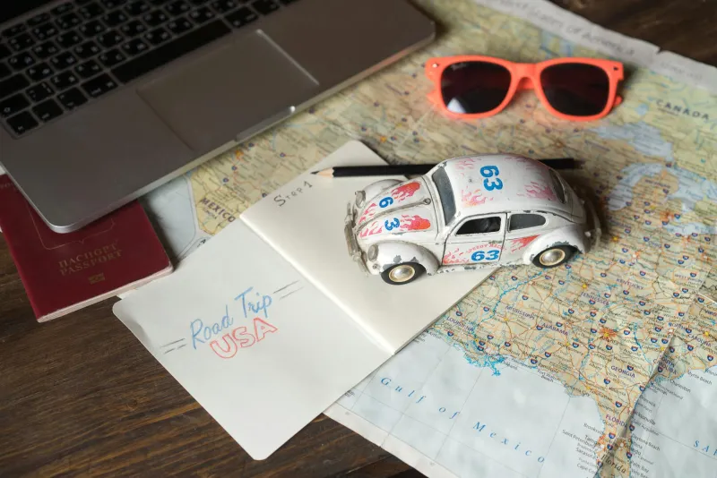
Somewhere in a box in your parents' garage, or maybe still wedged under the passenger seat of an older relative's car, there is probably a folded map. Not a clean, neatly pressed map — a battered, creased, coffee-stained map that was folded wrong a dozen times and never quite went back to its original shape. That map was someone's lifeline. It was how they got from one place to another in a country with no blue line telling them where to turn.
For most of the 20th century, navigating America required preparation, patience, and a fairly high tolerance for uncertainty. Getting lost wasn't an edge case or a system failure. It was just part of the trip.
The Pre-Trip Ritual
Before a road trip in, say, 1978, the process started days in advance. If you were organized, you'd stop by your local AAA office and request a TripTik — a spiral-bound booklet of strip maps customized to your specific route, annotated by hand by an actual AAA employee who knew the roads. It was a remarkable service, genuinely useful, and it required you to know your route before you left your driveway.
If you weren't a AAA member, you worked with road atlases — those thick, oversized books covering the entire country state by state. Rand McNally's Road Atlas was the standard, updated annually, and it sat in the back seat of millions of American cars like a co-pilot who couldn't talk. You'd trace the route with a highlighter, scribble notes in the margins, and fold specific state pages outward so you could glance at them while driving.
Highway signs helped, but they weren't always consistent. Exit numbers varied by state. Some signs pointed to towns you'd never heard of instead of the city you were heading toward. Junctions on rural routes could be genuinely ambiguous — a fork in the road with a rusted sign that gave you two options and no indication of which was the main road.
The Gas Station Oracle
When the map failed — and it failed — you stopped and asked someone. The gas station attendant was the unofficial navigator of American road culture. These were people who pumped your gas, checked your oil, and, when needed, leaned against your car window and drew a rough map on a paper bag.
"Turn left at the old Dairy Queen" was a real direction. So was "go past the water tower and then take the second gravel road after the church." Landmarks that weren't on any map — a barn painted with a Chew Mail Pouch Tobacco advertisement, a specific overpass, a grain elevator visible from the highway — these were the reference points of pre-GPS navigation.
The social transaction involved in asking for directions was its own small ritual. It required stopping, interacting, explaining where you were going, and trusting a stranger's mental model of the local roads. It was normal. People did it all the time. There was no embarrassment in not knowing where you were.
When GPS Arrived — and When It Actually Arrived
The GPS satellite network was built by the US military and became fully operational in 1995. But civilian GPS devices for consumer use were expensive, clunky, and not particularly common through the late 1990s. Garmin launched its first consumer automotive GPS unit in the early 2000s. By mid-decade, dashboard-mounted GPS units had become popular enough to be a standard gift category. They still required updates, sometimes charged for map data, and occasionally routed you confidently into a lake.
The real shift came with the smartphone. Google Maps launched in 2005. The iPhone arrived in 2007. By 2010, real-time turn-by-turn navigation was in the pocket of a rapidly growing share of the American population, free of charge, updated constantly, aware of traffic conditions, and capable of rerouting on the fly when you missed a turn.
In roughly five years, the entire cognitive infrastructure of American navigation changed.
What Happened to Our Sense of Direction
Researchers have spent the past decade studying what GPS dependence has done to the human brain, and the findings are interesting. The hippocampus — the region of the brain associated with spatial memory and navigation — appears to be less actively engaged when people follow turn-by-turn directions than when they navigate independently. Studies in the UK found that London taxi drivers, who must memorize an extraordinarily complex street network, had measurably larger hippocampal regions than non-drivers.
The concern isn't that GPS is making us dumb. It's that a specific cognitive skill — the ability to build and maintain a mental map of physical space — may be getting less exercise than it used to. Whether that matters in the long run is genuinely unclear. We stopped doing a lot of things that once exercised our brains, and we gained other cognitive capacities in return.
But there's something worth noting about the experience of disorientation itself. Getting lost, even mildly, created a particular kind of attention. You noticed the landscape because you were reading it. You remembered the route because you had to construct it. The town you stumbled through while looking for the highway had a name you actually retained.
The Thing About Getting Lost
There's a generation of American adults who remember the specific feeling of being in an unfamiliar city with a paper map, a vague plan, and no backup. They remember the low-grade anxiety of a missed exit, the slight triumph of finding the right road, the way a trip became a story partly because of what went sideways.
None of that was efficient. Some of it was genuinely stressful. But it produced a different relationship with physical space — one where your location was something you earned through attention rather than something a satellite handed you.
The blue line on your phone screen is more accurate than any paper map ever was. It saves time, reduces accidents, and makes unfamiliar cities accessible in ways they simply weren't before.
It just doesn't leave much room for the gas station guy.